The Heyfield Story
Prior to 1950 Heyfield was not a timber town. Certainly timber had been milled in the district in the late 1800s, but after that period, and before 1950, there were no major sawmilling operations because there was no timber resource of significance left on the doorsteps of the town. But there was a significant resource in the mountains to the north and, what is more, a resource of very high quality. So Heyfield became, for a period from the 1950s into the 1970s, one of the biggest, if not the biggest, timber towns in Victoria.
The Pioneering Years
As with so many areas in Victoria, the early years saw the forests in the vicinity of Heyfield harvested and then cleared for farming. The quotes immediately below come from "A Valley of Glens - The People and Places of the Upper Macalister River" - Linda Barraclough and Minnie Higgins (1988), Kapana Press. The Glenmaggie/Heyfield area is within "The Missing Forest".
"The Glenmaggie sawmills came into their own in the 1880s. By then many of the farms had been established for at least ten years, and had been profitable enough to allow more substantial homes to be erected. The magnificent red gums on the flats were eyed off, cut down and hauled by bullock teams to the mills. There they were cut into the weatherboards that were used to build some of the oldest homes in the Glenmaggie area."
"By the beginning of the 1890s all these mills had ceased to operate. Either they had satisfied the main demand, or, more likely, they had cut out as many of the giant red gums as were to be available."
"Information on the first sawmill to be built in the town of Heyfield is not available but there is evidence of activity as early as the 1920s. A number of older houses in the town were demolished from about 1950 onwards to make way for the new era of sawmilling. These dwellings were almost exclusively built using red gum timber and it is likely that the timber was locally produced, probably before or during World War 1. There was sawn timber produced in the district much earlier, however."
Post 1939
The 1939 fires were to force a shift of harvesting, after the major portion of the salvage program had been completed, into areas that were relatively unknown in forest terms, at the beginning of the 1940s. The areas in which timber harvesting in Gippsland was concentrated before the 1939 fires, and during the subsequent salvage operation, can be seen in maps available on this page.
"Victoria's major mountain ash forests and hardwood timber supply had been destroyed. These magnificent forests had been intensively logged since the 1920s, after a method of seasoning the ash had been developed. By 1938, over 80% of Victoria's flooring was made of mountain ash. It was also used for other joinery and cabinetry." (Fletcher, 1991)
"Two major events in Australia's history were important for the Heyfield sawmilling companies. An understanding of these events helps us appreciate the achievements of the companies and why they were established in this small Gippsland town. The first was the series of disastrous bush fires in January 1939 which destroyed vast areas of timbered country, homes and sawmills and caused the loss of 72 lives. Many of those who died were trapped in isolated sawmilling settlements. The fires killed practically all the ash forests within a hundred mile radius of Melbourne. The second event, which followed a few months later, was the outbreak of World War II in which Australia immediately became involved." (Howell, 1995)
Defining the Resource
The FCV was under considerable pressure to define the areas from which timber could be made available to replace the Mountain Ash resource lost in the 1939 fires. The mountain areas to the north of Heyfield and the east of Mansfield came in to focus. This in an era when there virtually no maps available for ground parties to use. If you peruse the FCVs Annual Reports for the period following WW11 into the early 1960s you will get a sense of the massive scale of the assessment and mapping programs undertaken by FCV crews across Victoria's eastern highlands.
In the first instance it was necessary to find the areas on which more comprehensive surveys could be conducted. Jim McKinty was the leader of a series of reconnaissance surveys in the mountains north of Heyfield and east of Mansfield in 1940/41.
"The Commission realised that the methodical surveys were too slow to produce the necessary information for planning the future of the timber industry. Jim was detached from the assessment crews to carry out a rapid reconnaissance of the largely unmapped mountain country of Gippsland to locate and estimate volumes in the remaining useful stands of timber, to determine when stands of ash regrowth would be available for thinning, and to identify those areas that could be made accessible with extra roading."
-and-"Starting on 19th February 1940, with local stockmen as guides and assistants, and “living like a dingo”, Jim reconnoitred the headwaters of the Macalister River system, particularly around the Bennison Plains, Connors Plains and west to Mount Useful, as well as the Barkly River catchment. He then worked through the Crooked River catchment and in the upper Moroka River. February 1941 saw him on the Dargo High Plains. His reconnaissance work finished on the 7th April 1941 in the Wentworth River basin." Jim McKinty - Forest Assessor.
The FCV increased its emphasis on resource surveys.
" ... it has been obvious to the Commission for some time that provision would have to be made at no very distant date for the re-establishment of a very considerable proportion of the sawmilling industry in new cutting areas. To ensure that the transfer should take place with a minimum of disruption to the industry and to the multitude of other industries dependent on it, the Commission early in 1942 set about the re-establishment of its Forest Assessment and Survey Division, so that the location and assessment of stands of virgin green timber of milling quality could be proceeded with and organization for utilization planned and lines of access determined." Annual Report - FCV, 1944/45
More detailed assessments followed.
"Over the summer of 1946-47, the Forests Commission carried out an assessment of 14,000 acres (5700 ha) of the main timber belt on the Great Dividing Range, north of Heyfield. Both Heyfield and Mansfield, on either sides of the Divide had been nominated conversion centres. Plans were made for a major roading system. The Country Roads Board was called in to build a road to tap into Connors Plain, north of Heyfield. In 1950, the Roads Board began investigating a road to cross the Divide and link Heyfield with Jamieson." (Fletcher, 1991)
-and-"It is proposed to open for logging in the near future the timber stands located in the mountain country north of Heyfield in the Briagolong Forest District. In order to secure necessary basic information for the organization of timber utilization and forest management, a detailed assessment of this area was commenced last summer. The main timber belt occupies the divide between the Jamieson, Black, and Aberfeldy Rivers to the west, and the Barkly and Macalister Rivers to the east, and extends from the Springs on the southern end of the Mount Useful Range northward through Spring Hill, Connors Plain, Mount Shillinglaw and Mount Skene to Mount McDonald. Approximately 14,000 acres have been assessed by parties operating from a camp at Tiger Creek on the Macalister River fall and the survey will be continued next summer in a northerly direction." Annual Report - FCV, 1946/47.
Detailed assessments continued in this area over the next decade and more, and Arthur Webb vividly describes the conditions experienced by FCV crews working in these areas. The Remarkable Pack Camps of the 1950s.
The First Timber Allocations
The first timber allocations into this new area were made by the FCV in 1949/50.
"In addition to log allocations totalling 29½ million superficial feet per annum approved during the previous financial year in the Licola timber belt, additional allotments from this area of 9 million superficial feet have been made to provide for two further mills to be erected at Heyfield, bringing the Commission's total annual commitments from the area to 38½ million superficial feet. A number of new allocations has also been approved in the Orbost, Bruthen, and Nowa Nowa localities, which as a result are developing into major sawmilling centres." Annual Report - FCV, 1949/50
"Nineteen fifty was an important year in the development of the Victorian sawmilling industry. A group of eight ash-species sawmilling companies commenced production of seasoning quality timber in North Gippsland, seven of them at the rail-head town of Heyfield and one at Licola, 53 kilometres to the north."
-and-"The companies had, with one exception, been involved in the logging and processing of the fire-killed ash forests of Tanjil Bren, Toorongo, the Upper Thompson and Erica. They had also, led by the Victorian Sawmillers Association, unsuccessfully lobbied for access to the stands of Mountain Ash in the Melbourne water catchment areas under the control of the Melbourne Metropolitan Board of Works. The establishment of the Heyfield group of mills was significant. It was the first time such a large number of mills had been simultaneously granted licences to log from a common forest area." (Howell, 1995)
Note: In today's terms 38½ million super feet HLV (Hoppus Log Volume) is equivalent to approximately 115,500 m3. Fletcher(1991) converts 38½ million super feet HLV to be the equivalent of 130,000 m3, which is incorrect. The error in this conversion may well be reflected in other sawlog allocations described by her after the 1950s, but in this article it is assumed that the percentage changes are correct and can be applied to the correct initial allocation of 115,500 m3.
Access and Harvesting
"Following the allocation of the eight licences to log the Connor's Plains area the Country Roads Board engaged in a major road reconstruction project to up-grade the road between Glenmaggie and Licola. The Forests Commission then made arrangements with the CRB to construct the logging road from Licola to Connor's Plains and beyond to Cullen's Creek. During the 1950s the North Road was extended to Lazarini's Spur and the South Road from Connor's Plains to the vicinity of Mt Useful."
-and-"In the early planning, it was proposed that Wilbur Saxton should undertake most of the logging operations to supply sawlogs to the Heyfield Mills. Wilbur later withdrew the proposal for group logging but, judging by a letter from Forests Commission Secretary G.K. Cockburn, this may have sown the seed for eventual group logging and the formation of the Heyfield Sawmillers Logging Co in 1959." (Howell, 1995)
This article draws heavily on "A New Beginning. The Story of Heyfield and the Sawmilling Industry, 1945-1995". This book by Brian Howell was written for, and published in 1995 by, the Heyfield Community Resource Centre. The FCRPA has permission to publish the book on this site.
Extensive quotes are also taken from "Alpine Forestry: Heyfield, a Case Study" by Dr Meredith Fletcher (1991).This map combines the McKinty recces of 1940/41 with the location of the future major timber extraction routes and other facilities in the region.
See also:
"A Valley of Glens - The People and Places of the Upper Macalister River" - Linda Barraclough and Minnie Higgins (1988), Kapana Press.
Aerial Seeding Native Forest
Annual Reports - FCV
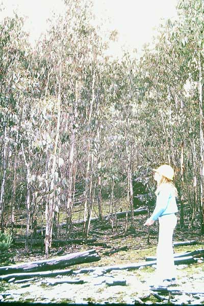
Alpine Ash
Connors Plains - S. Cowling
Post 1939 Recovery & Salvage
Jim McKinty - Forest Assessor
Maps
Tamboritha Road Project
The 1939 Fires
The Eddy Papers- Heyfield 1953-54
The Missing Forest
The Remarkable Pack Camps of the 1950s
Eucalyptus delegatensis subsp. delegatensis
Photo: Neil Blair
Copyright 2019 Royal Botanic Gardens Board
Creative Commons Licence CC BY-NC-SA 4.0
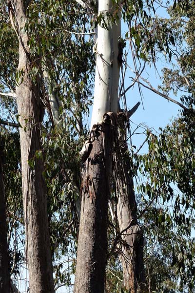
Connors Plain- South Road area, Heyfield FD: Alpine Ash regrowth
Photo: N Cox
About 1978
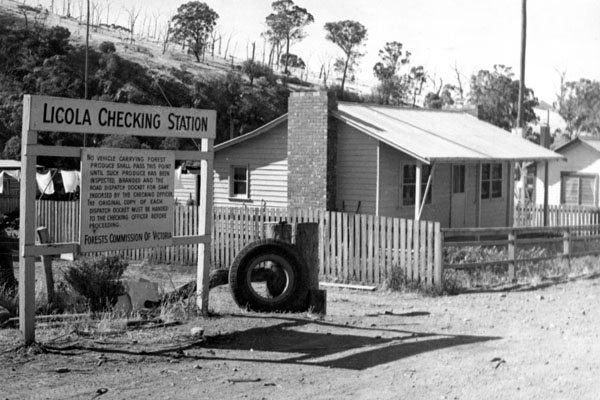
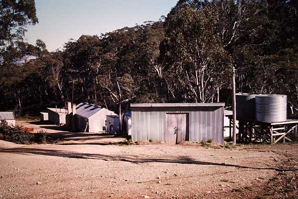
FCV Log Checking Station, Licola
Source: FCRPA
About 1958
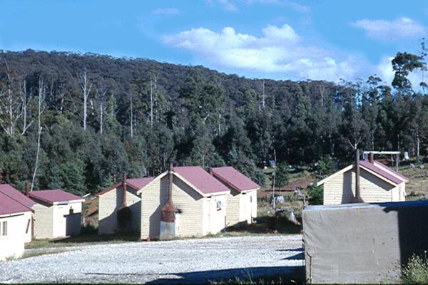
FCV Camp at Connors Plain
Source: B Fry
1963
FCV Camp at Surveyors Creek
Photo: N Cox
1979
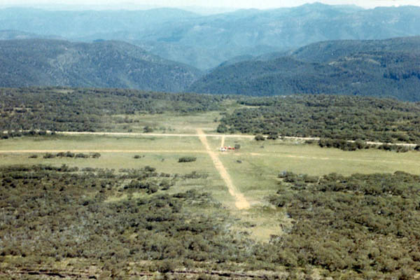
Snowy Range Airstrip
Source: B Rees
1971
The letter reads:
"23/12/49
Mr JW. Youl
With reference to the logging operations shortly to be commenced by the Licola group of millers, it is understood that several group meetings of the millers concerned have been held to discuss various matters associated with logging in the area. The Commission was interested in a recent statement by you of the possibility of logging being carried out by one logging organisation for the whole group of millers in the locality and would favour logging being carried out in this manner. It is felt that such procedure would be more efficient than individual logging operations by the millers, would facilitate fire protection and silvicultural work and should result in the most equitable distribution of logs obtained in the area.
Sec. FC/Vic."
Meredith Fletcher (1991) records that the first load of logs came out of Connors Plain on Thursday 16 February, 1950.
The FCV established a presence on Connors Plain with a camp established a short distance west of the junction of the new Licola to Connors Plain road and what is now known as South Road. The camp remained in place until the late 1970s to early 1980s.
Out of Connors Plain and North from Licola
Harvesting on Connors Plain finished after 1959. Assuming a sawlog output less than the allocation, but averaging 100,000 m3/yr, Connors Plain produced something like 1,000,000 m3 of sawlog, and an unknown quantity of pulpwood for APM at Maryvale, during the 1950s.
"The Heyfield Saw Millers' Logging Company (HSLC) was formed in 1959, and it gave the united sawmillers a powerful voice. It also meant that each sawmiller received a cross-section of timber logged in the mountains. It was only when the drivers reached the checking station that they knew where to deliver their loads. To help prolong existing reserves, the HSMLC organised an immediate (approx. 33% - editor) reduction in allocation ... (Fletcher, 1991)
Understanding that the resource available from Connors Plain would be harvested by about the end of the decade, the FCV began the enormous task of providing access to those stands in the mountains to the north of Licola, and the Tamboritha Road was the key that unlocked access to those areas.
"The Tamboritha Road was begun in 1959 and the main road network completed by 1963-64. For this undertaking, the biggest single roading project attempted by the Forests Commission, it transferred its roading equipment and men from the Mansfield - Jamieson projects. Les (Bull) Kennedy, the senior overseer was in charge of the base camp about four miles beyond Licola on Kevin Higgins' property. Later the Commission built a second roading camp at Breakfast Creek where Ray Brown was overseer in charge. When the road reached Mt Arbuckle a further camp was built at Surveyors Creek."
-and-"Considering the road construction equipment available in the 1960s, the Forest Commission did an outstanding job in building the roads, especially from Licola to Tamboritha. Much of the going was in steep country, with many road batters up to 50 feet high in hard rock. The bulldozers were all cable blade machines. There were no rear mounted rippers, and up to 30 men were used for rock drilling with hand-held jackhammers. 'Bull' Kennedy was known to be a pretty tough overseer and bush lore said he always had one crew coming on to the job and another going off."
-and-"Approximately two million dollars was spent on the road construction trom Licola to Point Q at Little Round Plain and Arbuckle to Carey Creek on the Mt Howitt road. The agreement was that the three parties, Government, Forests Commission and sawmillers, would bear the cost of the main road network equally. Secondary roading would be the responsibility and the role of the Heyfield Sawmillers Logging Company. Following the completion of this section the Forests Commission ceased road construction within the district except for two miles of costly roading at the Bastard's Neck, at the head of the Dry River." (Howell, 1995)
You can find more detail about the Tamboritha Road project in this article by Mal McKinty, and this map shows the location of the Tamboritha Road, and other main roads developed and upgraded by both the FCV and the HSLC.
"Reaching Tamboritha Saddle was significant. It meant that the south end of the highland plain country had been reached, and that road access to the various timber stands would be economically possible. The next stage, a connecting link between the Bennison Plains, Mt Arbuckle, Doolans, Moroka and Little Round Plain timber stands, would also provide access points for subsidiary roading to pick up timber in the Carey's Creek, Mt Reynard, Snowy Range and Macfarlane's areas." (Howell,1995)
At its formation in 1959 the Heyfield Sawmillers' Logging Company was managed by Bert Head, a VSF graduate of 1933, and it was very active in not only harvesting but in further developing the road network.
"The Logging Company then undertook a substantial roading program to provide access to the King Billy, Peters Creek and Mt Clear timber stands as well as those at Mt Kent and Mt Dawson. During the sawmilling life of the Heyfield mills, it has been estimated the Company built 1500 kilometres of main extraction and secondary roading."
From the earliest days on Connors Plain the FCV, at District level at least, had concerns about the sawlog allocation and the impact on the town if harvesting levels had to reduce significantly and rapidly. The sawlog allocation was reduced in about 1959, and in 1964 it was further reduced to about 50% of the original allocation.
In 1977 Fletcher (1991) records five major sawmilling and value-adding operations based on access to the Alpine Ash resource. The last harvesting in mature Alpine Ash stands in the area would have been in the late 1980s, in stands close to 100km from Heyfield.
Regeneration Issues
The silvicultural system that should apply to Alpine Ash is now well known. That was not the case when harvesting started on Connors Plain in 1950. The system used on Connors Plain was the same applied to Mountain Ash through the 1920s and 1930s - a seed tree system relying on soil disturbance during harvesting to provide a suitable seed bed. There were significant concerns during the period of harvesting on Connors Plain that the regeneration being achieved was unsatisfactory, and indeed concerns that in some areas the two stage harvesting process used to provide sawlogs and, during the next season pulpwood to APM at Maryvale, would result in less than optimal outcomes.
It was the research of RJ Grose during this time, that led to a clearfall and slash burn sivicultural system, that was to ensure satisfactory regeneration after harvesting in mature Alpine Ash forests. And it was in Alpine Ash near Mt Arbuckle that the first aerial seeding of harvested areas after burning took place.
Fires and Salvage
"Regeneration burnings by the Forests Commission at Mt McDonald and The Nobs in March 1964 broke away when unforecast gale force winds swept the district. The fires swept across the Macalister River country to blacken the Alpine Ash resources of Mt Tamboritha, Dingo Hill and McFarlane's. ... This fire badly affected the closer forest resource. It entailed a 34,000,000 super feet fire salvage operation during 1964-65." (Howell B, 1995)
-and-"The following year, 1965, there were further serious fires. ... A second fire, burning in the Valencia Creek catchment, was threatening the important Alpine Ash resources in the Little Round Plain unit. Although this fire had the advantage of burning uphill towards the Little Round Plain there was also a strong northerly wind blowing against the fire. With logging machines and crews to assist the Forests Commission, a fireline was built from the Pinnacles to Mt Wellington and the fire was generally contained along the divide between these two mountains, about ten miles apart."
-and-"As a result of this fire the Company had to mount another fire salvage plan during 1966 in the heads of the catchments of the Freestone, Valencia and Turton creeks and the Avon River." (Howell, 1995)
The End?
Not quite. In 2020 there is still a sawmill in Heyfield, even though the sawlog supply comes from areas outside the old Heyfield Forest District. Heyfield remains a good location for air drying timber prior to kiln drying and further processing. The mill is transitioning to become, after 2030 when harvesting of sawlogs from native forest is planned to cease, a plant processing imported timbers into high value products.