
This article was compiled in April 2021, based on personal experience (Kester Baines) and the original Alpine Walking Track leaflet, published by the FCV in 1974 with assistance from the Ministry of Tourism, and the Federation of Victorian Walking Clubs. A copy of a related article by Dennis Williamson in the FCV’s Inner Bark magazine was provided by Richard Hammond. Background information from The Scroggin Eaters: A History of Bushwalking in Victoria, to 1989, by Graeme Wheeler (1991) - excerpts supplied by Mike Leonard, and From Snow to Ash, by Anthony Sharwood (2020).
In 1968 the Tourist Development Authority (later the Ministry of Tourism) sought the advice of the Federation of Victorian Walking Clubs about the provision of walking tracks in the alpine region of Victoria. The concept developed for an Alpine Walking Track as a through route with entry points and access tracks at suitable intervals. Influencing this decision was the concept of a ‘tri-state trail’ traversing the high country of Victoria, New South Wales and the Australian Capital Territory. The route recommended was thought suitable for the Victorian section of the trail. The plan was accepted by the Ministry of Tourism, which in early 1970 provided the first financial grant towards the project. The Forests Commission was involved in the planning and negotiations mainly through its then Forest Recreation Officer Stuart Calder. The FCV agreed to act as the construction authority, and during the following summers track marking and construction work went ahead in accordance with the recommendations of a sub-committee comprising representatives of the three organisations.
The first work in 1970-71 was on an access track from Howqua along the Howqua River to Mount Howitt, a distance of 45 km, which involved re-opening sections of the old Howqua mining track. This track was marked with reflective yellow triangular markers, as distinct from the diamond-shaped markers of the Alpine Walking Track. The AWT markers featured a ‘walking legs’ motif and the words ALPINE TRACK, with production and distribution co-ordinated by PTC (Tom) Morrison, of the Forest Environment and Recreation Branch, FCV.
The Ministry of Tourism continued to provide funds, and members of clubs affiliated with the FVWC volunteered their time and energy to assist the Forests Commission staff. By the end of winter 1974 the AWT had been substantially completed, except for a couple of short sections where the route was still to be confirmed.
The track began at Mt Erica car park (later the track was extended to begin in the Walhalla township) and ended at Tom Groggin on the NSW border (changes were later made in this terminal section to facilitate connection as the track was continued into the Snowy Mountains of NSW and ACT).
Total length of the AWT in Victoria is about 400 km, with some 160 km of track being constructed to link the sections which are on fire access tracks and other minor roads. The track traverses some of the most remote and rugged country in Victoria and can be subject to extreme weather at any time of year. Water is scarce in some sections. Huts are not provided and hikers must be well-prepared to camp in the bush, although there are a few campsites with basic facilities provided, such as pit toilets. Because of the difficulty of the terrain and remoteness from any sizeable towns, the AWT has special appeal for experienced and committed walkers, although of course there are sections suitable for those seeking shorter and less demanding hiking.
See also:
Over the Alps - November 1975
The AWT - Inner Bark. ca. 1978
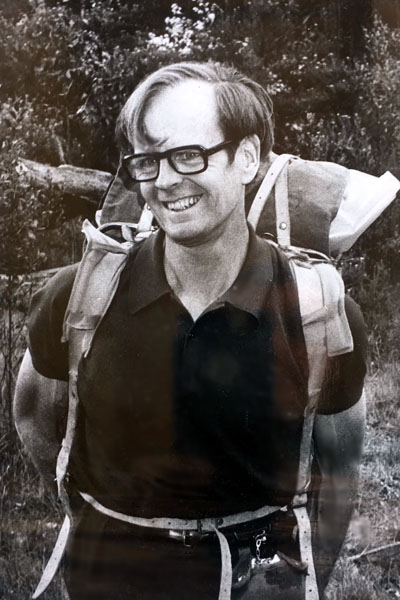
Stuart Calder
Probably early 1970s
Source: Calder Family
In the latter half of the 1970s, several multi-day hikes were done by FEAR (Forest Environment and Recreation) Branch members and others as follows, to assess track condition, marking and other management issues:
- Hotham Heights – Bogong High Plains – Mt Bogong - Mt Wills: Stuart Calder (2IC, FEAR Branch), Prof George Seddon (Melbourne University), Tim Colbatch (journalist, The Age) and Kester Baines (admin officer, FEAR Branch). This walk was the subject of a full-page article by Tim Colebatch, published in The Age of 15 Nov 1975. An abridged version of the article, without the pictures, was published in the commemorative volume 125 Years of Age, in 1979.
- Razor-Viking wilderness – Mt Speculation – Crosscut Saw – Mt Howitt – Macalister Springs: Stuart Calder, Peter Greig, Kester Baines (all FEAR Branch), and Ian McLachlan (Asst Divisional Forester, Traralgon). Ian took movie film of this hike.
- Mt Gibbo – Mt Pinnabar – Hermit Mountain – Murray headwaters (Little Bunroy Ck): Stuart Calder, Richard Hammond, Ken Keefe, Dennis Williamson, Kester Baines (all FEAR Branch). Richard, Ken and Dennis were the newly recruited American landscape architects. A detailed report of the trip, written by Dennis, was published as ‘Facing the Good, Bad and the Ugly on the Alpine Walking Track’ in Inner Bark, journal of the Forests Commission Social Club, n.d., probably 1978.