Walking to Work
M E W Stump (bio)
2003
"Mark gave me a copy of the text in March 2016, together with some photographs and newspaper cuttings. The descriptions of dry firefighting with hand tools are brief and record what was achieved year by year over and over by experienced firefighters, day and night, in public forests, at modest cost, more than half a century ago."
Alan Eddy, 30 April 2016
Mark Stump was an Assistant Forester at Heyield from December 1954 to May 1957
"The philosophy attaching to the combatting of remote fires at that time, was that the suppression crew should be self-sufficient for a period of three days. This principle assumed that a three-day period would provide sufficient time in which to access, extinguish and withdraw from a small fire without the necessity of additional support. For a large remote fire, which could not be dealt with in an all up time frame of three days, the self-sufficiency period provided time for District Administrative Staff to organize the despatch of support equipment/supplies, to be carried to the fire site by pack horse."
The fire which broke out in Victoria's Alpine National Park in January 1998 became a "hot" news item. Notwithstanding that pre-planning, years earlier by the former FCV, had led to the construction of an air strip at Snowy Range, and that on-site provision had been made at that air strip for mixing and loading fire retardant for firebombing purposes, the fire had proved difficult to combat. Perceived suppression difficulties contributed to tactical indecision in the early stages of the outbreak. A media report informed that the Department of Natural Resources and Environment - the combatting authority - had resolved to control the outbreak by the indirect method of back burning, from strategic control lines, as and when the fire should threaten areas of settlement. If that decision had actually been made, it was overruled by the State Premier following a surveillance flight over the fire area.
I followed the media reports of the fire progress with great interest for two particular reasons. The first, because I had a clear mental picture of the locality where the fire had burnt initially, based on “on ground" experience. Secondly, for the reason I had led a firefighting party from Licola into that same area some forty-three years earlier in 1955, at a time before there was any form of vehicular access, and prior to the use of aircraft for firefighting purposes in Victoria. At that time the status of the public land was designated as Unoccupied Crown Land.
By present day standards, the appearance of the party of firefighters that I had led would be perceived as very unprofessional. If anything, the only visual evidence of possible cohesiveness distinguishing that motley attired crew, lay in the fact that each man carried an identical backpack. Those rather nondescript steel-framed packs were uniform in size, uniform in the drab green/brown colour and uniform in the apparent absence of any manufacturer's logo. To all intents and purposes that group of young men might well have been members of a bush walking club.
My party of fire fighters was selected from among direct employees of the then FCV, engaged primarily for road construction duties within the Macalister Forest District (headquarters at Heyfield), who were based at the construction camp at Connors Plain. This camp was established on the line of the Great Dividing Range, at an elevation just above the snow line. Construction work tended to be of a seasonal nature, with a climate-enforced "off period" due in part to snow fall. Because of this "off period" there was always a proportion of itinerant workers among the complement of District employees. Nevertheless, the work force included a hard core of men with dry firefighting experience in difficult to access mountain terrain.
As the Forest District name "Macalister" implied, the territorial area, administered from the headquarters at Heyfield, extended as far as the Great Dividing Range, encompassing the watershed of the south-draining Macalister River and tributaries.This area closely aligns with the Gippsland occurrence of what is described as the "sandstone belt" - a tract of Devonian and Carboniferous sandstones and conglomerates striking across the Great Divide in eastern Victoria. The Grampians, in western Victoria, are representative of similar Devonian and Carboniferous sandstones and conglomerates.
The then State Rivers and Water Supply Commission had a strong presence at Heyfield, which was the works centre for the Macalister Irrigation Area. The source of water for the MIA is the Glenmaggie Reservoir, constructed on the lower reaches of the Macalister River, just north of Heyfield. By early 1955 the State Rivers and Water Supply Commission was well advanced in a major construction project, the object of which was to increase the storage capacity of the Glenmaggie Reservoir, by raising the height of the floodgates on the concrete retaining wall of the dam.
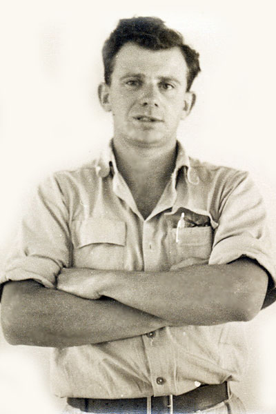
Mark Stump - mid 1950's
Source: Heather Batchelor
Irrigation is fundamental to the prosperity of the rural population peripheral to the regional centres of Heyfield, Maffra and Sale. This portion of the East Gippsland plain is within a zone of rain shadow generated by the strategic position and elevated bulk of the Baw Baw Plateau and Mt Erica. The rain shadow prevails over an area to the east, and in the lee of Mt Erica, including much of the Macalister River catchment which is vegetated with a dry sclerophyll forest cover.
The selected fire crew made a rendezvous at Licola to partake of a lunch of sandwiches, and to meet with the District Forester, Val Cleary, OIC of the Macalister Forest District. Val had brought with him certain equipment for our use from the Fire Protection Store, located at Heyfield. Items included backpacks, sleeping bags, ex-army emergency rations which were to be our food staple, and above all a copy of a walking club map. This map provided some very basic information relating to rivers and creeks, the nomenclature of same, and the relative position of walking tracks and the huts erected by mountain cattlemen. It was devoid of any contour or hachure lines. Limited as it was the map was the best available at that time and was indispensible to the effort we were about to make.
The philosophy attaching to the combatting of remote fires at that time, was that the suppression crew should be self-sufficient for a period of three days. This principle assumed that a three-day period would provide sufficient time in which to access, extinguish and withdraw from a small fire without the necessity of additional support. For a large remote fire, which could not be dealt with in an all up time frame of three days, the self-sufficiency period provided time for District Administrative Staff to organize the despatch of support equipment/supplies, to be carried to the fire site by pack horse.
District experience had shown that lightning strikes rarely "took off" immediately. Thunderstorms are not indicative of extreme fire weather; rather such storms are usually associated with conditions of high humidity, and sometimes with local rain, inimical to the rapid spread of fire. Notwithstanding the problems associated with accessing remote fires in mountain country, an experienced suppression party on site within the first 12, or even 36 hours following detection, could be accorded a good chance of being able to control and extinguish the fire.
We were obliged to carry some bulky and heavy essentials of which the RC 16-B radio transmitter/receiver was the most conspicuous. Enclosed in its protective, rectangular metal case, with the speaker housed in the hinged fold-back lid, and weighing about 28 lbs, it was a most awkward and heavy item to accommodate in a backpack. This sophisticated piece of electronics was powered by a bank of dry batteries, prepacked by the commercial firm EVEREADY, into a relatively slim rectangular block (not unlike a ream of foolscap paper) and weighing about 15 lbs. The remaining units of the communication equipment comprised the metal peg used to earth the system and the coil of copper wire representing the half wave aerial.
The sleeping bags were brand new and quite extraordinary. Stiff and wedge shaped in plan, they comprised a heavy canvas outer cover lined internally with a grey woollen blanket much heavier and far more bulky than a custom made sleeping bag (and as we were to find, much less efficient). They couldn't be pushed or scrunched into the angles or spaces in a backpack. Each man carried a baked enamel water bottle in a cotton webbing holster and also a torch and spare batteries. Items like an inflatable mattress, weighing of the order of 5-7 lbs, and single person hiking tent, were optional. Most of the party opted to forgo these comforts to reduce the load to be carried. The pre-packed army emergency rations comprised three meals sealed in a metal cannister. A couple of small liquid fuel primus heaters were carried, together with supporting fuel. Each man had a pannikin and set of aluminium cutlery, also various little heating containers and plates.
The work tools were limited to one axe and five rakhos per six men. Again, in the case of the rakhos, there was an option whether the individual chose to carry a complete tool or simply the metal head with the intent of manufacturing a wooden handle from local timber, anticipated to be found at the fire site. An axe stone, metal and wood files, some nails to secure handles to tool heads and some cord were included. By the time personal items, medical kit, and in my case a camera (an optimist, if ever there was one, to imagine it wouldn't prove to be the proverbial "straw that broke the camel's back") were packed, we were ready to go.
Val had ascertained from cattlemen in Heyfield that after leaving the Wellington River to ascend the Bennison Spur, we could not expect to find drinkable water prior to reaching the high plains - a stretch of something like ten miles and much of it very steep. So, we carried several empty one gallon canvas water bags, intending to fill them from the river after reaching the Bennison Spur. Bushwalkers these days carry much heavier and more bulky loads than we were obliged to and with greater ease. Our packs were generally less than 60 lbs weight, but the pack did not permit of the load being distributed effectively, the entire load being largely supported by the shoulders. Nor were the carrying straps effectively padded and of course we had not trained to carry heavy packs for extended periods.
While lunching, we had considered how best we might reachthe foot of the Bennison Spur. There were two options available to us. The most direct route entailed scaling the great ridge separating the valleys of the Macalister and the Wellington Rivers, starting from Reeves property on the Macalister River. Initially, this route demanded a long steep climb to the vicinity of a high point of rather more than 3,000 ft ASL identified as Mt Margaret, then a descent crossing the valleys of Thieles Creek and the Dolodrook River en route to the Wellington River and the foot of the Bennison Spur. It was a hot, humid day and the prospect of a long wearisome, strenuous climb on an exposed western aspect was unattractive, more especially as nearly all the elevation gained would become "lost" on the descent to the Wellington River. There was also the consideration that we would have to carry full water bags from the outset, whereas if we followed the line of the Macalister and Wellington Rivers, it would not be necessary to fill the water bags prior to late afternoon. This latter option, a rather more indirect route, was unanimously chosen as the preferred way to go.
We started walking about 1300 hours, moving in single file and especially after having entered the Wellington River valley, confining our progress to the narrow slip bank of the river. The Wellington River flows through a narrow valley with great bluffs on either side. We couldn't walk on the cut bank without having to climb the bluffs, and the river was at its deepest beneath those sections, the water washing against and around boulders which had tumbled from the surrounding precipitous cliffs. The obligation to keep to the slip bank necessitated crossing and re-crossing the river, again and again. Irrespective of each person's skills and physical abilities, it was obvious their ultimate usefulness in that country would depend on the condition of their feet - a lame firefighter would be a liability. Walking with wet feet in sodden boots didn't seem a good option, so the progress along the valley had an element of tedium, removing and replacing footwear.
The afternoon was very hot and very humid and although the water looked inviting it was actually rather tepid. Exposed surfaces of rocks in the river had become heated in the sunlight and were uncomfortably warm to the touch. There was no breeze as such to relieve the heat, so we sweated profusely and ingested salt tablets which was the recommended measure to prevent cramping. Intermittently during that afternoon we did experience brief puffs of hot air which we likened to the sporadic opening of the door of a great oven. It was a novel experience to me and I wondered whether there might be a katabatic influence affecting air on the high country beyond the river valley.
Sometimes the river was up to waist deep where we were obliged to ford it, at other times barely shin deep. It wasn't hard to visualise how bushwalkers could become stranded in valleys like that, because the stream had the potential to rise very quickly in response to local thunderstorms or general heavy rain. I think we were obliged to ford the river about once every mile on average - sometimes the distances were shorter and at other times longer. We took it in turns to act as leader, and adopted a pattern of changing over roughly every hour, with a ten minute rest at each change.
The river is home to creatures like the Eastern Water Dragon, but they were shy and for the most part only the person in the lead had opportunity to sight them. During that afternoon we became aware of the occurrence of more thunderstorms over the mountains; we didn't experience any rain and while the scope of sky that could be seen from the recess of the valley was quite limited, we were not particularly aware of dark clouds or thunder heads. Our awareness came from the sound of thunder which seemed to reverberate in the valley and was occasionally very loud.
We were able to plot the progress of our march tolerably well from the course of the river as presented on our map. Our approach to Dinner Creek was anticipated from the map and our arrival was confirmed by the presence of a piece of corrugated, galvanised iron affixed to a tree, with the words "DINNER CREEK" presented in white paint. Dinner Creek had significance because at that point the Wellington River made a great curve which encompassed a ravine known as Crolls Gorge, which we wished to avoid. Having correctly identified Dinner Creek, we scaled the spur to the east of the river and having crossed it, descended back to the Wellington River at its confluence with Gorge Creek. The foot of the Bennison Spur was reached in the late afternoon; the elevation was probably only about 500 feet ASL but from this point we would climb to elevations exceeding 4,500 feet ASL.
We had a swim in the river which had become refreshingly cool in the deeper pools as lengthening shadows stretched across the water. As much as anything, it was an opportunity to wash the sweat out of clothing, shirts in particular having become quite stiffened. After that, we sampled the first of our meals from the army rations while we drip-dried on the river bank. I recall having been moved by the change of light over the water - in the sunlight the river had sparkled and its depth, rock ledges and submerged boulders could be perceived. But in the absence of sunlight that ability was lost and the stream had an almost sinister characteristic.
My plan was to make an assault on the Bennison Spur that evening, hoping to put some of its steepest gradients behind us prior to the end of our day. I wanted to tramp for two hours unless darkness forced us to make an earlier overnight camp. The water bags had been filled and we took ten minute turns at carrying them as additional burden.I had never known ten minutes to be such a long interval of time when one was doing the carrying, nor such a short interval when someone else was doing the carrying. It wasn't as if the water bags were all that heavy in themselves, although the gallon of water represented an additional 10 lb load which was certainly not insignificant. What hurt us was that without the impediment of the water bags, our arms had been free to push impeding vegetation aside and to give support to our packs, either by supporting it from below or by grasping the shoulder straps. There had been no problem while following the river track, but on the Bennison Spur where we were obliged to push the vegetation aside and scramble over fallen tree sections, the evening tramp proved rather punishing.
After two hours we just laid down where we were. It was well after sunset but there had been sufficient light to permit of our continued walking. I reasoned that with a likely hot day coming on the morrow, we would be thankful to have some of the hardest sections of gradient behind us. We might even be able to tramp under the shade of forest cover, rather than in open sunlight as had been the case in the Wellington River valley. The possibility of shade was attractive, but if there was an undergrowth to have to push through, the uphill walking would become that much more exhausting, shade or no shade - but I didn't voice that thought. The immediate difficulty lay in finding a comfortable secure place for sleeping, because the crest of the Bennison Spur had assumed proportions approaching those described as "knife edge". On our right hand the land fell away sharply into the valley of the Carey River, while on our left there was a comparable decline into an apparently unnamed creek. Our campsite on the crest of the ridge became quite strung out as each man selected a tree to provide stability from the downslope side. One could lie "along the slope" or preferably "across the slope" in reasonable comfort as long as there was a decent sized tree to rest against, thus ensuring you would still be there at daylight.
The early dawn saw us up and about, albeit rather stiffly at first. One of our canvas water bags had leaked overnight, the unforeseen depletion of our water supply causing me some concern. The residual supply was rationed to the extent of one mug of tea per man for breakfast, a decision which had a comical outcome. There had been no problem associated with consumption of the pre-packed evening meal at the Wellington River, but the breakfast pack included carrot biscuits which proved extraordinarily hard. Several of the party had dentures and found themselves quite unable to cope with these biscuits. The biscuits didn't soften appreciably when dunked in tea and the others in the party were unwilling to make trades for more carrot biscuits. In the end a solution was found. By hammering and grinding those biscuits between two stones, they were rendered suitable for mastication. The carrot biscuits were the only component of the food packs not to receive approbation. I was obliged to relent on my water rationing plan, making extra tea available to wash down the debris of carrot biscuits.
My hope that we had left the steepest gradients on the Bennison Spur behind us, quickly proved unfounded. Our map had proved adequate to plot our position while negotiating the river course, but having commenced the ascent of the Bennison Spur, the map was inadequate to enable us to fix our position. We had not been conditioned to carrying heavy packs for sustained periods and the omission was beginning to show. The going quickly became more strenuous and the steeper gradient of the spur was sustained.
Steadily, but ever so slowly it seemed, the character of the eucalypt forest cover changed. Stringybark, peppermint and box gave way to silvertop, then we encountered alpine ash and finally snow gum. Clearly we were about to reach the Mt Tamboritha Plain but still the going was uphill. At last we emerged from the snow gum forest with Mt Tamboritha on our left. Ahead of us, on the far side of the plain, stood a cattleman's hut, identified from our plan as Chesters Hut. Behind the hut, and affording some shelter, was a small stand of fine alpine ash.
Our spirits lifted pereptibly as it became evident that the seemingly endless uphill trudging was at last behind us. It seemed that after hours of arduous walking we were in a position to set about accomplishing the task of fire suppression that had brought us thus far. We had no inkling that the weather held an unpleasant surprise in store for us, nor that the planning of our fire attack strategy would be on hold until the following morning.
The first act was to upack the components of our communications equipment from within the various backpacks that had stowed the items. Having made the unit operational, I was able to advise our headquarters at Heyfield that we were near Chesters Hut on the Mt Tamboritha Plain. In return, advice was received that the storms of the previous day had initiated five or six more fires. Of these, one in the Caledonia River valley was potentially the most difficult to access. Poor visibility had prevented sighting from other than one lookout, so the position of that fire was as yet not pinpointed. A reinforcing party was being sent in from Briagolong - "where should they meet up with us?" I nominated Kelly's Hut, still some miles further on from where we were, and added that it might be a good site for a base camp. I proposed to leave some of my party at Kelly's Hut to set up camp, prepare those rakhos requiring handles for service and to be on hand to meet the Briagolong crew.
From our position on the Tamboritha Plain, there was nothing to be seen in the way of rising smoke to indicate the proximity of bush fires. Nevertheless, I anticipated that it would be prudent to divide the combined manpower resource into a number of small working parties - at least initially - in order to have a presence at, and to receive a situation report concerning each fire, as speedily as possible. For that reason I proposed taking three men with me from Kelly's Hut to Mt Reynard, to see if the Caledonia River fire could be sighted from that point. Because our plan showed only the lines of water courses, it seemed important to me, that several persons should independently make a visual appreciation of the location of any fire that might be seen. Included among those chosen to accompany me to Mt Reynard were Ian Thomas (Forest Foreman) and John Wilson (Leading Hand). I anticipated we would be back at Kelly's Hut before sundown.
We repacked the communications equipment and resumed the trek towards Kelly's Hut. Traversing the open plain was much less arduous than the ascent of the Bennison Spur. We passed several stock yards, ingeniously constructed from round pieces of snow gum, the structures looking as if they had been there forever - the timbers bleached and dessicated through years of exposure to the elements. The mountain cattlemen who had constructed the yards, required them for their annual round ups, when the free ranging cattle were brought together to be sorted according to their brands, prior to being brought down from the mountains before the onset of winter.
Having reached Kelly's but it was an enormous relief to divest our packs, and shortly after having done so, each individual appeared to have enhanced stature. After setting up the communications again, the Mt Reynard party set off with lighter steps. The weather was deteriorating rapidly as we neared Mt Reynard which was some thirty odd miles from our start at Licola, and which we reached in just under eleven hours actual walking time.
We barely had opportunity to sight what appeared to be smoke in what was known as the "butcher country" in the Caledonia River catchment, before we were caught up in low cloud and fog with visibility down to about twenty-five yards. The high plains are not the place for wandering about when you cannot see landmarks; everything assumes a general sameness and each little clump of snow gums looks like any other. There was ample opportunity to regret having divested our packs, but we had done so with the utmost relief and what had been done was done. All we could do was stay at Mt. Reynard, out of contact with the people at Kelly's Hut, trying to keep warm and desperately hoping for the cloud and fog to dissipate quickly. That didn't happen and with time very much against us, it became obvious that we were going to spend an unplanned night in the open. We availed of some rocks, which although open to the sky did offer some prospect of lateral protection from wandering breezes, and kindled a fire in this bivouac.
In the very early hours of the morning there was another thunderstorm. It came suddenly, drenching us through and through. As it turned out, it was the last storm in the particular cycle of weather at that locality and though we didn't know it at the time, the rain actually did us a good turn in checking the run of one of the fires we were destined to attend. There was little we could do other than scramble to save our fire with protective pieces of rock. No longer was there a source of cheerful comforting warmth, but it had suddenly become a matter of priority to preserve a glimmer of light in that wet darkness. The lightning flashes afforded brief glimpses of each other's bedraggled misery and as the night wore on we were all silently preoccupied with the thought that we were sodden, cold, tired, hungry, without shelter and miles from anywhere. After the storm we blundered about to locate dead weed/shrub material and small sticks which were divided into a number of bundles each calculated to give about an hour of burning, and sufficient in number to last until daybreak. Much of the time was spent trying to coax our "fire" to continue burning and in that regard at least, we were successful.
Daylight was an awfully long time coming, but at last it did, bringing with it clear visibility, enabling us to make a very welcome departure. Our last act prior to departing was to tramp out the vestige of our fire. It seemed ironic that having expended so much time and energy throughout the night, to protect and sustain the light that we needed so desperately, we could tramp it out without remorse at daybreak.
When you are cold and wet there is nothing revives flagging spirits more than does bright sunshine. Even the prospect of a breakfast that included carrot biscuits, did nothing to diminish the speed we made to Kelly's Hut that morning. The physical exertion expended in our walking, combined with the warm early sunshine, soon had the effect of making our cold, wet garments much more bearable. Just occasionally, we found ourselves walking towards the sun, and on those occasions vapour could be clearly seen rising from the backs of the leading walkers - very literally we "steamed" our way back to Kelly's Hut.
At Kelly's Hut we met with Ross May (Assistant Forester) and the Briagolong crew, who were awaiting a planned drop of another copy of the walking club map, which Val Cleary had arranged to be conveyed by light aircraft. This map had been marked to show the locations of the various fires, but because the map lacked contour or hachure lines, the ground parties still faced the unknowns of how best to locate and access the fire sites. Ross May advised that his party had dealt with one of the fires - at Mt. Arbuckle - on their way to the rendezvous at Kelly's Hut. In the course of the next few days all of the fires, including that in the Caledonia River valley, were located and extinguished.
The rakhos were the prime fire combatting tool and as the name suggests the "rakho" was a combination rake and hoe. The head comprised a flat rectangular steel plate approximately 10" (25.5 cm) wide by 9" (23 cm) from top to bottom. One of the 10" sides was bevelled to provide a strong sharp cutting edge, while the opposing 10" side was fabricated to provide six strong tines each about 3½" in length. By simply rotating the handle 180 degrees the rakho could be used at will, either as a cutting or chipping tool or as a rake.
Using rakhos, supported by an axe as required, a trail cleared of all flammable material and excavated into mineral earth, was constructed around the perimeter of each fire. These trails were roughly 3 feet (1 metre) in width. The initial attack was directed at the head of each fire, usually the upslope side, working on the edge of the fire if possible. As opportunity offered, the flammable material accumulated by trail construction, was raked into the fire area and burnt. Occasionally circumstances would have required less direct action. In such instances the trail would have been constructed at a distance from the advancing fire, the suppression crew back burning from the trail as the construction progressed. On steep gradients, the downslope sections of the enclosing trail were made wider and were cut in the nature of a trench. By so doing, any coals or other burning material rolling downslope from within the fire area, would become trapped rather than escaping into unburnt areas of fuel. All on-ground flammable material within the perimeter of the enclosing trail was burnt out.
The selection of tools we had carried was well suited to the requirements of "dry" fire fighting, inclusive of dealing with heavy solid fuels. Heavy on ground fuels do not necessarily ignite readily. The presence of tree sections on the ground may even impede the initial progress of a fire until the burn can progress around one or both ends of the obstruction. Heavy fuels require to be well desiccated to become ignited. Hollow tree sections are most prone to ignition because there is usually an abundance of decomposed wood, both sliver like and granular in appearance, within the hollow interior, and on the ground beneath and around the log. This fine material kindles readily and the hollow acts as a chimney. Two men wielding axes can split even large hollow logs along the grain, exposing the internal fire and enabling the pieces to be pulled away on to burnt ground. The flames can then be extinguished either by chipping the burning wood away with a rakho or axe, or by smothering the flames with earth.
Solid wood sections require the sustained presence of a heat source to become well alight. Beds of hot ash and coals can be raked away from contact with such fuel. Round timber can be cut to serve as levers to roll heavy wood sections the half or full turn sufficient to isolate the heat source. The externally burning sections can then be cut away with an axe.
Standing burning trees can be felled with axes if necessary, or the fire area can be increased to ensure that the "hazard" is well surrounded by burnt ground. Some degree of surveillance to detect "spot fires" might be necessary until the burning section collapsed or until the act of tree felling had been completed.
Additional food supplies were brought in by packhorse to sustain our presence during this period. Our last act prior to vacating our base at Kelly's Hut, was to revisit all of the fire sites to verify the effectiveness of the suppression activity. With this task completed, the entire party withdrew as a body, walking out via Mt Arbuckle and Cromwell Knob to a vehicular pick-up which conveyed us to Briagolong via Valencia Creek.