
Maps
Download the map to enable viewing at different scales.
Peter McHugh has put together a Google map showing forest heritage sites.
Major Fires
Major Fires & Fire Seasons
This map has been derived from a dataset,"Fire History Records of Fires across Victoria" produced by Data Victoria.
The 1938/1939 map shows all the features in the dataset as does the 1964/65 map.
The 1977 Creswick fire is on this map because it was a very personal attack for many of us.
The 1982/1983 map focuses on the most significant fires.
The 2002/2003 Alpine Complex map shows all of the features available, as do the maps for 2006/07, 2008/2009 and 2019/2020.
The translation of the data into this webmap means that you should treat the areas shown as good, but not precise, interpretations of the base data. More information will be made available when we have had time to do some labelling of the areas shown.
There were major fires in 1926 and 1932 affecting the mountain ash forests east of Melbourne, but no map data are available for either of them.
See also: Major Fires
Tramlines & Sawmills
Victoria's Timber Tramways, 1945
Erica, Tyers, Thomson Tramlines and Sawmills (1910 -1950)
This map is based solely on information generously provided by Mike McCarthy, who is a member of the Light Rail Research Society of Australia and the author of several books related to Victoria’s history of sawmilling, and the use of tramlines to move sawlogs to mills and sawn timber to market. It has been prepared by digitizing four maps provided by Mike. All of the maps overlap to some extent, and the image below shows the areas of each map from which data have been extracted.
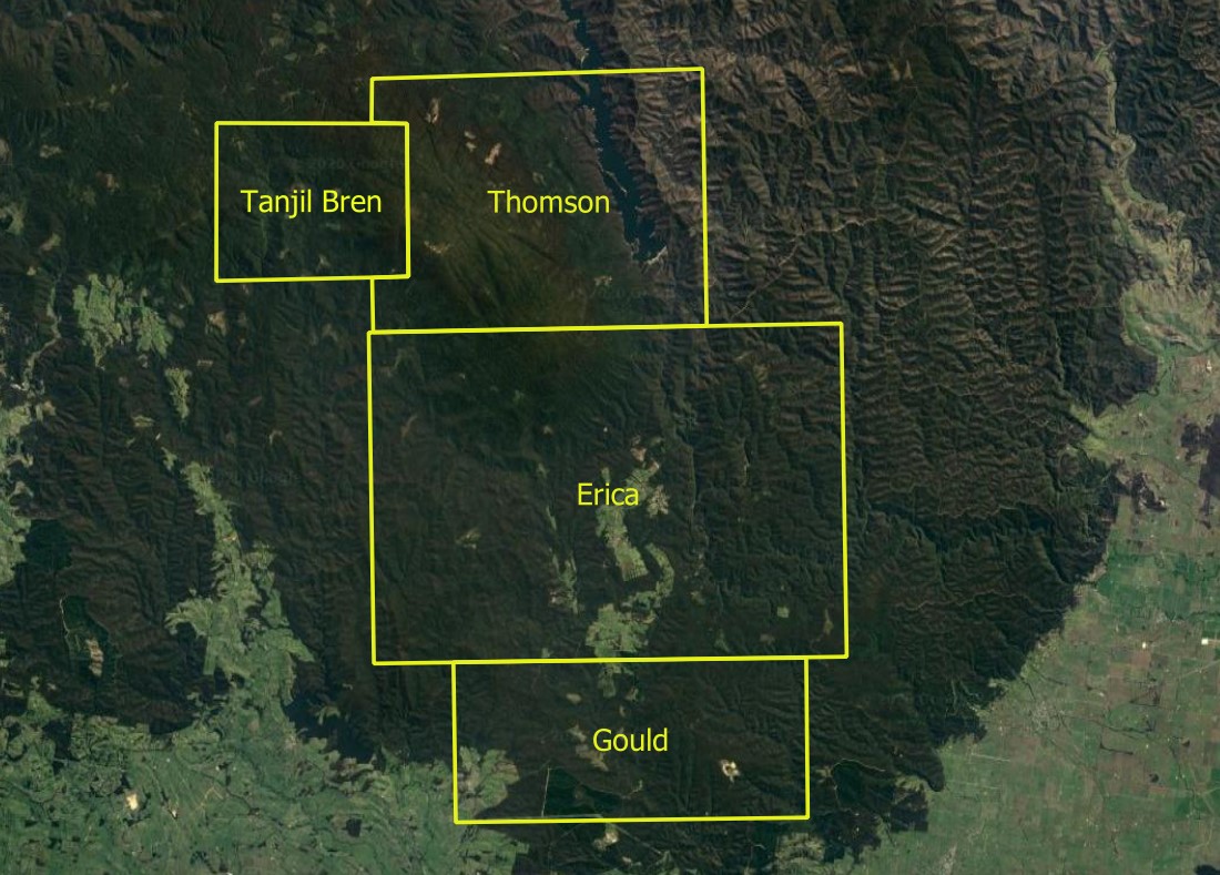
There are about 61 sawmill sites and approximately 420 km of tramline shown on this map as a whole. The map by map breakdown is:
- Erica - 28 sawmills & 318 km of tramline - of which the FCV owned 25 km, sawmillers 164 km, and those associated with mining and Walhalla and the adjoining settlements total 129 km.
- Gould - 13 sawmills & 43 km of tramline.
- Tanjil Bren - 16 sawmills & 30 km of tramline of which the FCV owned, but did not operate, about 5.5 km. The remaining lines were owned by sawmillers.
- Thomson - 4 sawmills & 29 km of tramline of which the FCV owned about 20 km.
Post 1939 Recovery & Salvage
FCV Sawmills
The FCV's Erica Tramline
Tramline Photo Gallery
West Gippsland Plus - Tramlines & Sawmills late 1800's to mid 1900's
This map is based solely on information generously provided by Mike McCarthy, who is a member of the Light Rail Research Society of Australia and the author of several books related to Victoria’s history of sawmilling, and the use of tramlines to move sawlogs to mills and sawn timber to market. It has been prepared by digitizing eight maps provided by Mike. The maps overlap to some extent and the image below shows the areas of each map from which data have largely been extracted.
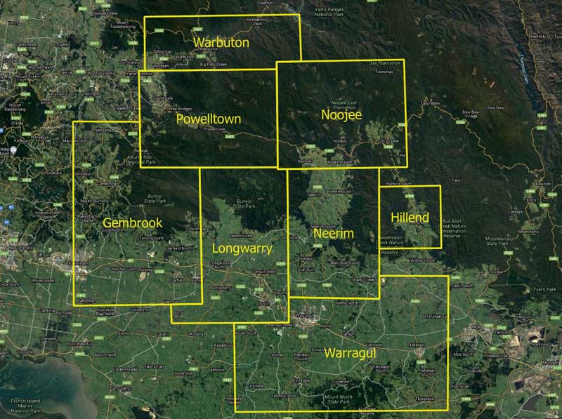
There are about 446 sawmill sites and approximately 1247 km of tramline shown on this map as a whole. The map by map breakdown is:
- Gembrook - 88 sawmills & 200 km of tramline.
- Longwarry - 40 sawmills & 120 km of tramline.
- Neerim - 29 sawmills & 102 km of trmaline.
- Noojee - 36 sawmills & 118 km of tramline.
- Powelltown - 131 sawmills & 395 km of tramline.
- Warbuton - 52 sawmills & 169 km of tramline.
- Warragul/Hillend - 70 sawmills & 143 km of tramline
The McIvor Tramlines
There are two maps in the pdf that is available. One is on an Open Street Map base and the other on a Google Hybrid base. Both have been prepared, with permission, from information contained in:
Tooborac, Victoria
by
Frank Stamford
2014
This book is available for purchase at the LRRSA Site.
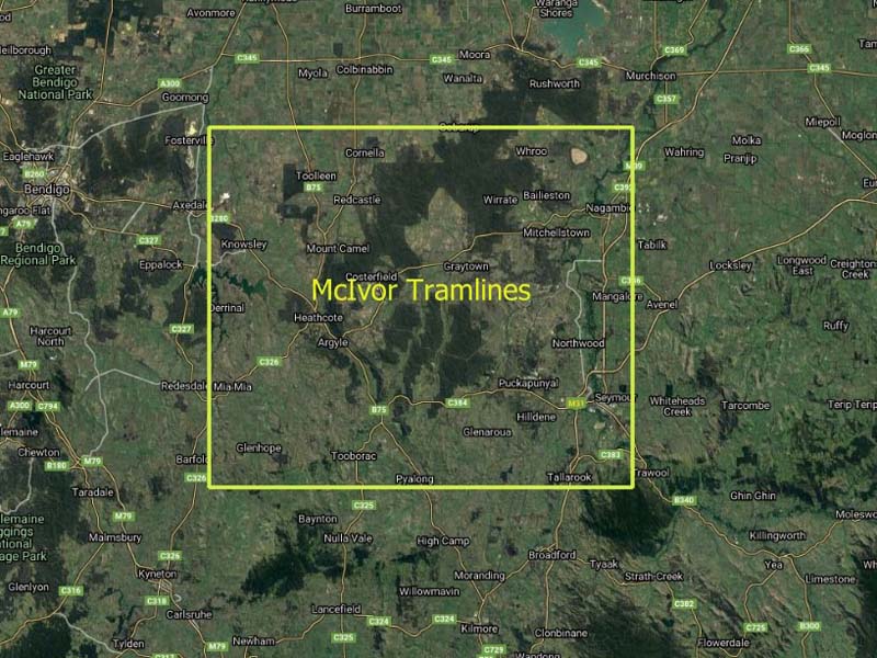
The Penrose & Oddy tramline was about 7.5 km in length. The McIvor Tramlines cover a total distance of about 80.5 km.
"The Mclvor Timber & Firewood Company operated from its headquarters at Tooborac, central Victoria from 1906 to 1927. Its main purpose was to supply firewood to the Bendigo and Melbourne markets. The firewood was mostly obtained from private properties north-east and north of Tooborac. These properties were being cleared of their trees to enable their use for grazing." (Stamford, 2014)
... but it also transported mining timbers and thousands of poles and sleepers cut in State Forest.
See also: The Warrowitue & Moormbool Forests
The Murrindindi Sawmills & Tramlines
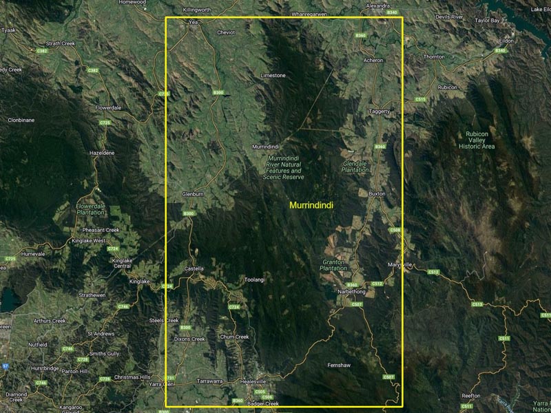
This map has been prepared, with permission, from information contained in:
Timber Mountain : a Sawmilling History of the Murrindindi Forest
1885-1950
by N. Houghton
The locations of 88 sawmills are shown on the map, and the length of tramline is about 315 km.
See also: The Murrindindi Forest
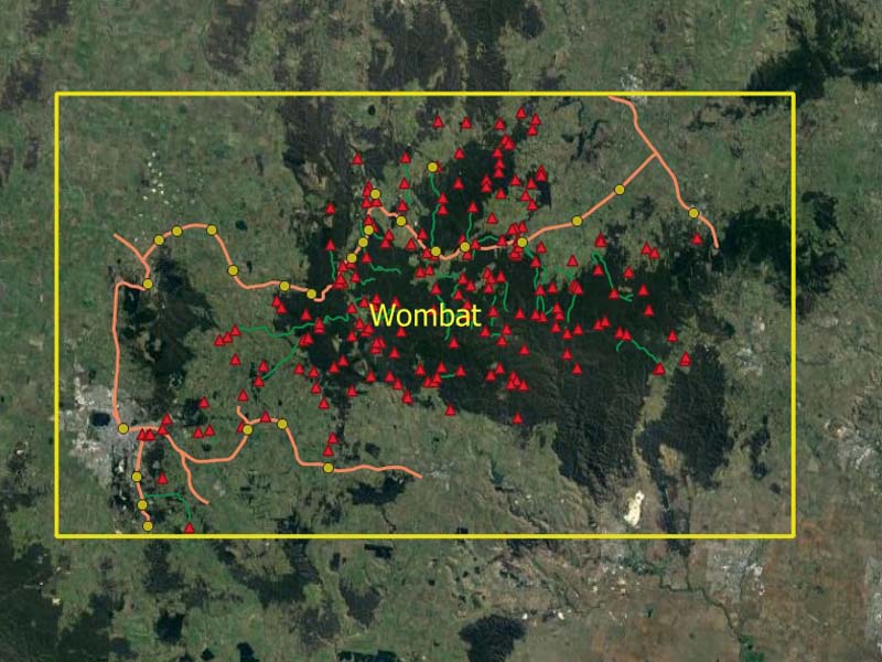
The Wombat Sawmills & Tramlines
Wombat Woodsmen
Sawmills and timber tramways of the Wombat State Forest
1853 to 2008
N Houghton
The sites of 193 sawmills are shown on the map, and an estimate is that about 75% of these sites were occupied in the period from 1853 until about 1910. The length of tramline is about 163 km.
See also : The Wombat Forest
The Otway Sawmills & Tramlines
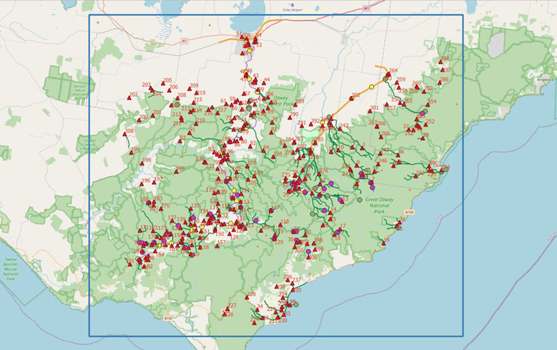
Choppers and Chippers.A History of the Timber Industry in the West Otway Ranges. N Houghton. 2018
Sawdust and Steam. A History of Sawmilling in the East Otway Ranges. 1850-2010. Norman Houghton. 2011
The sites of 308 sawmills are shown on the first map. The length of tramline is about 470 km.
The Timeline Map shows sawmills that were present in one or more years of the relevant 5 year period.
West Gippsland Plus - Sawmill Sites Through Time
This map combines Mike McCarthy's data from the above Erica, Tyers etc. map and the West Gippsland Plus map. Where dates are available, the five year periods within which a sawmill existed on a given site have been used to classify sawmill locations through time. A sawmill that existed for one year only will still be shown as present in the relevant five year period.
Mt Disappointment Tramlines & Sawmills
This map is based upon tramline data prepared by Colin Harvey, and other locations from a 1971 FCV Map prepared by M Wade. Have confidence in the tramline routes, but the sawmill location information needs to be checked. It is however, useful as an indicator of the extent of timber harvesting in the late 1800's and early 1900's.
See also: Mount Disappointment Forest
Heywood/Portland Sawmills
This map is wholly derived from information contained in:
Of Sawyers and Sawmills. Garry Kerr, 1995.
Rubicon Sawmills, Tramlines & Sites
This map is wholly derived from information contained in:
Rails to Rubicon Peter Evans, 2009.
Mt Cole Sawmills
Derived from a map in Beattie & Shalders 1990.
Forestry Locations
Forest Nurseries
With a lot of assistance from many FCRPA Members, the map below shows the location, as best we know them, of Victoria's forest nurseries from 1872 onwards.
See also: Forest Nurseries
Firebombing Bases
With a lot of assistance from Bryan Rees, the map below shows the location of past and present firebombing bases.
See also: Firebombing
Forestry Camps
This map shows the locations of forestry camps across Victoria that came into being for a variety of reasons. There will undoubtedly be camp locations that are not recorded here. Please let us know of others of which you are aware.
FCV Plantation Zones 1977
FCV Districts, Reserved Forest & Forest Types, 1928
This map is based on a map that was included in the Victorian Handbook prepared by the FCV for the Empire forestry Conference 1928.
FCV Districts, Forest Reserves & Crown Land 1943
FCV Districts, Forest Reserves, Crown Land
& National Parks 1948
FCV Fire Towers and Radio Facilities 1981
This map, produced by the FCV Draughting Branch, shows the locations of fire towers, radio stations and firebombing bases in 1981. Download to display full size.
McKinty & Heyfield
Timber Reconnaissance - Heyfield
JA McKinty 1940 and 1941
This map is based upon the original maps and notes of JA McKinty, and it covers his reconnaissance work of 1940 and 1941 in what would become the FCV's Heyfield District.
See also: Jim McKinty - Forest Assessor
Heyfield - Timber Town
This map is connected with this story about Heyfield from the 1940s onwards.
Public Use
FCV Maps for the Public
The FCV produced a number of maps that were designed to be used by the general public and you will find more maps in Forest Guides.
Central Highlands 1965
Mount Cole State Forest
Strzelecki 1975
Grampians 1981
Macalister Watershed 1959
Gunbower Island
Whipstick Forest
Forest Types
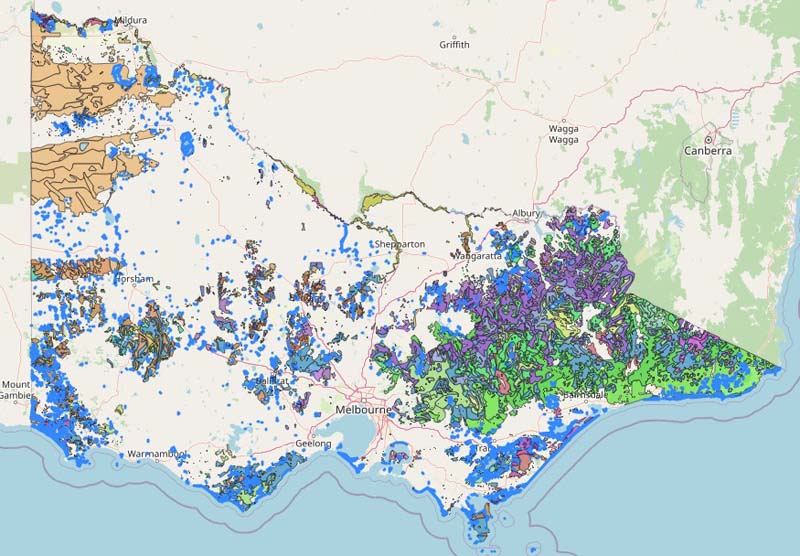
Victorian Native Forest Types
This map is based upon a data set provided by Data Victoria.
Vic Forest Types -
The map is not useful at a scale larger than 1:500000.
See also: FCV Vegetation Map 1981
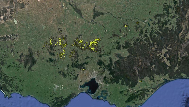
Victorian Box Ironbark Forest
Then and Now
This map is based upon data sets provided by Data Victoria.
They show the distribution of Ecological Vegetation Classes (EVC) 61 & 20 as at 2005, and the projected extent of the same EVCs as at 1750.
There are pockets of Box-Ironbark near Anglesea, Mt Taylor and Mt Raymond that do not appear on this map.
The map is based on a lot of data and may take some time to load - be patient.
Box Ironbark Forest -
See also: Native Forest Silviculture in Victoria.
Forest Areas
This is a map showing the approximate area of, and some information about, the Heytesbury Settlement Project.