
Mt Cole
This article is an access point for the information we hold about the Mt Cole forest.
Notes from Mt Cole State Forest
"The Mount Cole State Forest straddles the Great Dividing Range about 175 kilometres (110 miles) northwest of Melbourne, on the northeast edge of the Western Victorian Plains. The Mount Cole Block and its adjacent Mount Lonach Block comprise about 12,150 hectares (30,000 acres) of a total 22,250 hectares (55,000 acres) of State Forests in the district."
"Sawmilling commenced in the Mount Cole area during the 1840s when the old pit mills, using hand saws, were set up to provide timber for the pastoral runs then being established. The first recorded steam mill in the area was set up at Hickman's Creek by Henry McGie in 1856. Utilization continued unabated until 1904 with upwards of 30 mills operating full-time, and as practically all timber worth milling had been cut, the forest was then closed to utilization." ... "In 1947 the forest was reopened for timber utilization ... "
Thomas Bailes
"Thomas Derham Bailes arrived at Beaufort, Victoria, in 1899 to take up the post of Forester for the Mount Cole Reserve. He stayed for thirty-eight years in his official capacity and, like most foresters, displayed a passion for protecting the forests under his care from foolish and wasteful exploitation."
Beattie & Shalders - 1990
"Mt Cole virgin forest was one of the first cut in Victoria and the oldest records indicate that it was almost a pure messmate cut. In half a century of almost unrestricted cutting the forest supplied hundreds of poles, eighty feet in length, and untold quantities of shingles, piles and sawn timber. The mills were in the forest and moved from time to time as each area was cut out."
"By 1904 this valuable forest had been so depleted that the Government closed it to commercial enterprise for almost 50 years. The Forestry Department carried out an extensive silviculture programme between 1932 and 1947 and in 1947 opened the forest to sawmillers by departmental logging on a yearly quota of seven million superficial feet, this amount being reduced to nearly half in 1961."
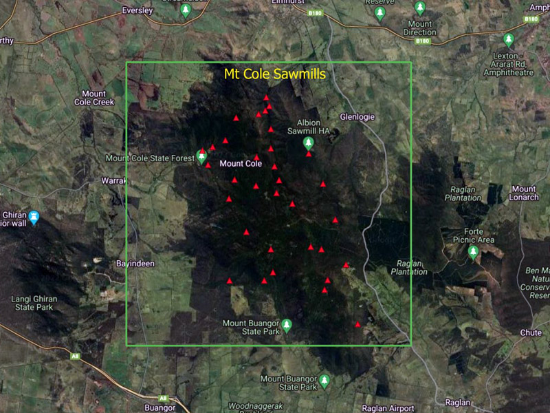
The map above was derived from Beattie & Shalders (1990). A webmap version is available via the link below.
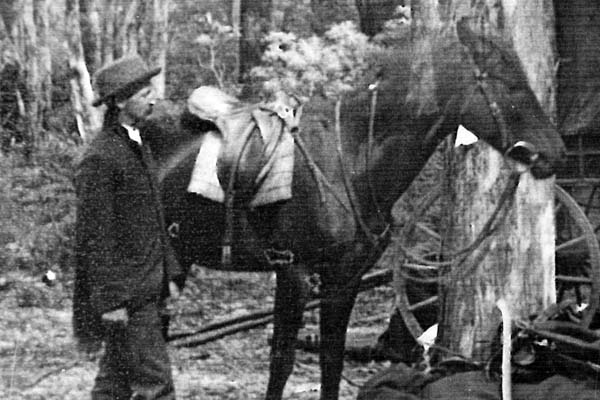
Tom Bailes
Source: Bronwyn Shalders
See also: The State library has a hard copy of work done by Peter Evans during the Regional Forest Agreement process.
A study of historic sawmill and tramway sites in the west forest region Victoria
&
Tree Decline and Mortality in Selectively Logged Forests in Central Victoria
&
Mt Cole State Forest Map
"On another occasion LCC staff needed to know which forest had supplied the poles that supported the roof of the famous Murtoa wheat storage shed, which had been built about 1941, as there were no forests of that height in the Wimmera region. The filing systems were scant on this subject, but revealed who was in charge of the operation. I then rang Jack Gillespie who told me the trees came from Mount Cole, and the name of the timber cutter." Source: Paul Barker
See this Video - Murtoa Stick Shed